Geodatadays 2025
Just like last year, we were there to meet with many key players in the geodata field.
From September 10 to 11, 2025, Parc Chanot in Marseille hosted the 8th edition of the GeodataDays, the must-attend event for all players in the geographic data sector in France. This annual gathering, under the theme “Acting in a Changing World: Indispensable Geodata”, highlighted the central role of geographic data—often called the “black gold of the 21st century”—in transforming our societies and territories.
A booming sector with major economic stakes
The opening debate, moderated by journalist Françoise de Blomac, immediately set the stage for the strategic importance of geodata for the French economy. The sector already accounts for nearly 52,000 jobs, generates €400 million in revenue, and is experiencing particularly strong growth in agriculture (+8%). The outlook is promising, with the ecosystem aiming for €700 million within the next eight years.
However, this dynamism hides several structural challenges. Speakers pointed out the inadequacy of existing business models, particularly in the face of competition from major digital players (GAFAM). Other recurring bottlenecks include the development of skills in data processing (especially with the rise of AI), the need to improve data qualification, and the difficulty of accessing financing. Emerging solutions are taking shape: public authorities are encouraged to design their own economic models around geodata, while initiatives such as the Caisse des Dépôts’ Tech Sprint propose new frameworks focused on territorial resilience, under the supervision of the European Union.
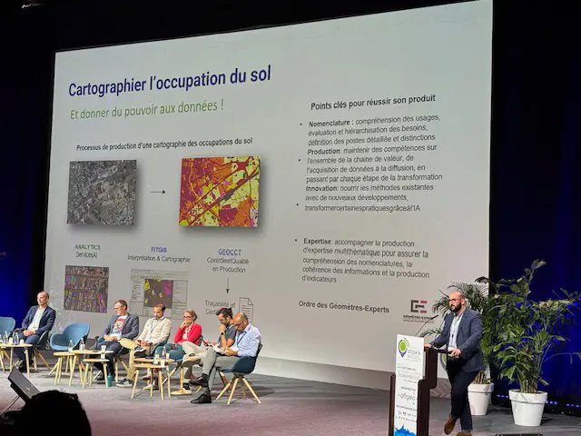
Innovation at the heart of the workshops
Throughout the two days, participants attended around ten workshops dedicated to the sector’s key advances, offering a comprehensive overview of geodigital innovation.
GIS and Artificial Intelligence: The Workflow Revolution
The DOTIC workshop explored the integration of generative AI into Geographic Information Systems (GIS). Here, AI does not replace GIS—it enhances them, introducing the concept of “Generative Business Intelligence” to generate new insights from the semantic relationships of geographic data. This solution, designed for security and performance, follows a process where raw data is never stored: only metadata is used, and all access is read-only. The processing chain integrates AI, SQL query generation, security analysis, and web implementation.
From IGN to Local Actors: Tools and Services with Impact
The IGN workshop highlighted a central issue: data fragmentation, the challenges of standardization, and the lack of coordination. IGN is responding with adapted tools and collaborative methods inspired by “commons.” Priorities are voted on by stakeholders, based on consensus and available funding. Our discussions with IGN highlighted the need for roadside mapping as one of the demands integrated into this approach.
Major projects are already available or underway, including Panoramax, the BAN (National Address Database), Carte Facile, Foreg, and version 3 of the National Forest Database.
Forests, Risks, and Environment: Geodata in Action
The forestry session showcased the decisive contribution of geodata to environmental monitoring: from national remote sensing to pest surveillance, precise mapping of undergrowth, and modeling with LiDAR and convolutional neural networks. These innovations support forest resource management while monitoring carbon storage—a major issue, as forest area is expanding but storage capacity is declining. Forest management, though costly, was confirmed as an essential tool for limiting fires. The National Forest Fire Database (BDIF) plans new monitoring packages in the near future.
Geodata for Society: Mobility, Heritage, Safety, and Urban Planning
Other workshops shed light on various geodata applications:
Sustainable mobility (ECOLAB): creation of multi-scale indicators to equip territories for efficient, low-impact transport.
Urban heritage (Smart Origin): metropolitan-scale tree and plantation management and mapping, exemplified by projects such as Smartrees and Canopé 93.
Civil security: massive use of open source tools in wildfire response, with the Nexsis platform migrated under OSGeo.
LiDAR processing (Mappia): transforming field videos into georeferenced images, then producing 3D network maps (gas, fiber).
Urban Planning and ZAN: Strategic Reflections and Tools
Finally, the presentation of the Zero Net Artificialization (ZAN) strategic framework illustrated the rapid evolution of geomatics methods. ZAN regulations require precise knowledge of natural, agricultural, and forest areas (ENAF), using tools that combine human expertise with artificial intelligence. The work integrates spatial modeling, multi-spectral analysis (visible, infrared, etc.), and land, economic, and environmental indicators. This approach enables the development of multi-sectoral platforms that support public action and adjust urban planning from a long-term perspective.
Geodata, a Key Lever for the Future
The conclusion was clear: GeodataDays 2025 confirmed that geodata holds tremendous transformative potential to address today’s ecological and economic challenges. However, this requires strengthened skills, adequate funding, and collaborative governance that matches the scale of the challenge. More than ever, the alliance of technological innovation, sector structuring, and multi-stakeholder dialogue appears as the driving force behind an enhanced, responsible, and sovereign geography.